Summer is now well-underway across Europe and many of us are planning our holiday escape with travel comparison websites and web mapping services.
Low-cost air carriers, fast trains, and cross-national motorways have made travelling across the Old Continent a quick and often cheap affair. But let's imagine that cars, trains and planes haven't been invented yet and that your options are limited to ox or mule cart and ships.

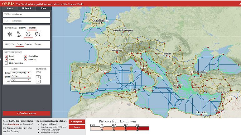
Their model, called ORBIS, consists of 632 sites spread across 10 million square kilometres of terrestrial and maritime space, covering most of modern Western Europe and the Mediterranean coast in North Africa and the Middle East.
The tool generates solutions for travel between any two sites depending on specific means and mode of transport and the months of the year, providing different options based on time and expense.
Read the rest of this article...
No comments:
Post a Comment
Note: Only a member of this blog may post a comment.